SpatialData Object
The SpatialData object forms the foundation for analysing spatial omics data.
Core Concepts
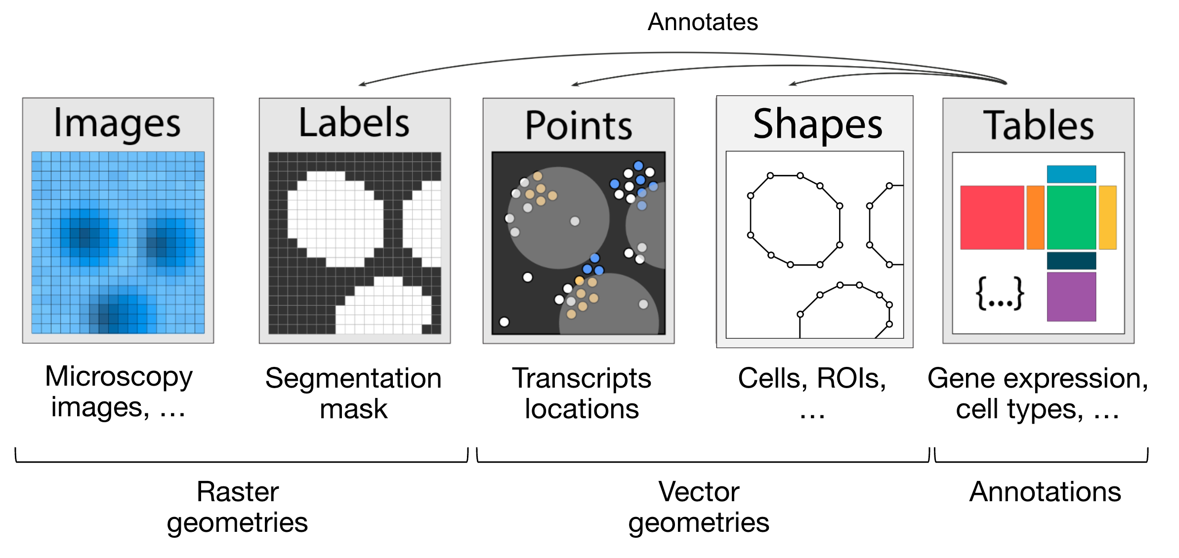
A SpatialData object is a container for Elements, which can be either:
SpatialElements:
Images: e.g. H&E stains
Labels: Segmentation maps
Points: Transcripts or landmarks
Shapes: Cell/nucleus boundaries or regions of interests (ROIs)
Tables: Annotate spatial elements or store metadata (non-spatial).
Categories
Rasters: Pixel-based data (Images, Labels)
Vectors: Geometry-based data (Points, Shapes)
Transformations
Vectorisation: Converts Labels → Shapes (shapely polygons)
Rasterisation: Converts Shapes/Points → Labels (2D image representation)
Visualization
You can explore a SpatialData object visually using the
spatialdata-napari plugin. See CosMx Strategy and Xenium Strategy for more instructions.